Smart City Initiatives
Smart city initiatives across the United States are driving the demand for HD maps, as urban planners and local governments seek to enhance infrastructure and improve public services. The US HD Maps Market is increasingly influenced by the need for accurate geospatial data to support various applications, including traffic management, public transportation, and emergency response systems. For instance, cities like San Francisco and New York are implementing smart traffic systems that rely on HD mapping to optimize traffic flow and reduce congestion. The market for smart city technologies is expected to reach USD 1 trillion by 2025, indicating a robust opportunity for HD map providers. As cities continue to adopt these technologies, the US HD Maps Market is poised for growth, driven by the necessity for detailed and reliable mapping solutions.
Enhanced Data Analytics
The rise of enhanced data analytics capabilities is significantly impacting the US HD Maps Market. Companies are increasingly leveraging big data and machine learning to analyze traffic patterns, user behavior, and environmental changes, which in turn informs the development of HD maps. This analytical approach allows for the creation of dynamic maps that can adapt to real-time conditions, thereby improving navigation and route planning. The market for data analytics in the transportation sector is projected to grow at a CAGR of 20% through 2026, suggesting a strong correlation with the demand for HD mapping solutions. As businesses and municipalities recognize the value of data-driven decision-making, the US HD Maps Market is likely to benefit from increased investments in advanced mapping technologies.
Government Regulations and Policies
Government regulations and policies play a crucial role in shaping the US HD Maps Market. The Federal Highway Administration and other regulatory bodies are increasingly emphasizing the need for accurate mapping data to enhance road safety and infrastructure planning. Recent initiatives aimed at improving transportation safety standards have led to a heightened focus on HD mapping technologies. For example, the implementation of the Infrastructure Investment and Jobs Act is expected to allocate significant funding towards improving transportation infrastructure, which includes the development of HD maps. This regulatory support not only fosters innovation but also encourages collaboration between public and private sectors, thereby driving growth in the US HD Maps Market. As regulations evolve, the demand for compliant and high-quality mapping solutions is likely to increase.
Integration with Autonomous Vehicles
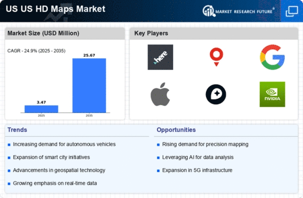
The integration of HD maps with autonomous vehicles is a pivotal driver in the US HD Maps Market. As the automotive sector increasingly shifts towards automation, the demand for precise and real-time mapping solutions escalates. HD maps provide essential data for navigation, obstacle detection, and route optimization, which are critical for the safe operation of autonomous vehicles. According to industry estimates, the autonomous vehicle market in the US is projected to reach USD 60 billion by 2030, thereby significantly boosting the demand for HD mapping solutions. This integration not only enhances vehicle performance but also contributes to the overall safety and efficiency of transportation systems. Consequently, the US HD Maps Market is likely to experience substantial growth as automotive manufacturers and tech companies invest in advanced mapping technologies.
Rising Demand for Location-Based Services
The rising demand for location-based services (LBS) is a significant driver of the US HD Maps Market. As consumers increasingly rely on mobile applications for navigation, delivery services, and location tracking, the need for accurate and detailed HD maps becomes paramount. The LBS market in the US is projected to reach USD 40 billion by 2026, indicating a robust growth trajectory that directly correlates with the demand for HD mapping solutions. Businesses across various sectors, including retail, logistics, and tourism, are leveraging HD maps to enhance customer experiences and optimize operations. This trend suggests that as the appetite for LBS continues to grow, the US HD Maps Market will likely expand in tandem, driven by the necessity for precise and reliable mapping data.


