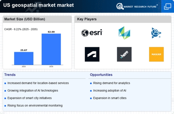
Expansion of Geospatial Data Analytics
The expansion of geospatial data analytics is significantly influencing the geospatial Market Industry. Organizations are increasingly recognizing the value of spatial data in driving business intelligence and decision-making processes. The integration of big data analytics with geospatial information allows for deeper insights into consumer behavior, market trends, and operational efficiencies. The US analytics market is projected to grow to over $200 billion by 2026, with a substantial portion attributed to geospatial analytics. As businesses seek to harness the power of data-driven strategies, the geospatial Market Industry is poised for continued growth, offering innovative analytical tools and platforms that cater to diverse sectors.
Rising Demand for Location-Based Services
The geospatial Market Industry is experiencing a notable surge in demand for location-based services. This trend is driven by the increasing reliance on mobile applications and the need for businesses to enhance customer engagement through personalized experiences. According to recent data, the market for location-based services in the US is projected to reach approximately $30 billion by 2026, reflecting a compound annual growth rate (CAGR) of around 25%. Companies are leveraging geospatial data to optimize logistics, improve marketing strategies, and enhance operational efficiency. As consumers increasingly expect real-time information and tailored services, the geospatial Market Industry is likely to expand further, providing innovative solutions that cater to these evolving needs.
Emergence of Advanced Geospatial Technologies
The geospatial Market Industry is witnessing the emergence of advanced technologies such as LiDAR, drones, and 3D mapping. These innovations are revolutionizing data collection and analysis, enabling more accurate and efficient geospatial solutions. The use of drones for aerial surveys has gained traction, providing high-resolution imagery and real-time data for various applications, including agriculture, construction, and environmental monitoring. The market for drone-based geospatial services is anticipated to exceed $5 billion by 2025 in the US. As these technologies continue to evolve, they are likely to enhance the capabilities of the geospatial Market Industry, offering new opportunities for businesses and government agencies alike.
Growing Importance of Environmental Monitoring
Environmental monitoring is becoming increasingly critical within the geospatial Market Industry, driven by heightened awareness of climate change and sustainability. Organizations are utilizing geospatial data to track environmental changes, assess natural resources, and manage disaster response efforts. The US government has allocated substantial funding for environmental monitoring initiatives, with investments expected to surpass $8 billion by 2025. This focus on sustainability is prompting businesses to adopt geospatial technologies that facilitate compliance with environmental regulations and promote responsible resource management. Consequently, the geospatial Market Industry is likely to see a rise in demand for solutions that address these pressing environmental challenges.
Integration of Geospatial Data in Urban Planning
Urban planning in the US is increasingly incorporating geospatial data, which is reshaping the geospatial Market Industry. Planners and policymakers are utilizing advanced geospatial analytics to make informed decisions regarding land use, infrastructure development, and environmental sustainability. The integration of Geographic Information Systems (GIS) has become essential for visualizing spatial data and assessing the impact of urbanization. As cities strive to become more sustainable and efficient, the demand for geospatial solutions is expected to grow. The US urban planning sector is projected to invest over $10 billion in geospatial technologies by 2025, indicating a robust growth trajectory for the geospatial Market Industry.


