Market Trends
Key Emerging Trends in the Photogrammetry Software Market
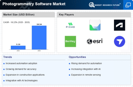
Significant changes are occurring in the photogrammetry software industry due to technological improvements and growing demand for 3D modeling and high-precision mapping solutions. The process of extracting geometric information from images, or photogrammetry, has become indispensable in a number of industries, including urban planning, construction, and agriculture. An emerging trend in the market for photogrammetry software is the use of cloud-based solutions. Cloud computing has transformed data processing and storage, facilitating easy accessibility and collaboration.
Cloud-based platforms are becoming more widely available from photogrammetry software suppliers, allowing users to access their projects from anywhere and handle enormous datasets remotely. With the increased scalability and decreased requirement for substantial hardware infrastructure brought about by this move to cloud-based solutions, photogrammetry is now more widely available to a wider range of users. The incorporation of machine learning (ML) and artificial intelligence (AI) algorithms into photogrammetry software is another noteworthy development. These technologies aid in the automation of point cloud formation, feature extraction, and image processing. Large volumes of data may be analyzed more quickly and accurately using photogrammetry software driven by artificial intelligence, which boosts the productivity of the mapping and modeling stages. This pattern shows that using clever algorithms to manage challenging jobs and improve photogrammetry solutions' capabilities is becoming more and more important. The market for photogrammetry software is also being impacted by the development of drone technology. Drones with high-resolution cameras are frequently utilized for mapping and aerial surveying. In response to this development, photogrammetry software now provides specific tools for processing images taken by drones.
Drones and photogrammetry software work together to rapidly acquire comprehensive spatial data, which is a great asset for businesses like agriculture that need to monitor crops, manage the environment, and create infrastructure. Additionally, photogrammetry software is showing a discernible trend toward more user-friendly interfaces and intuitive workflows. Software developers are giving accessibility first priority as the user base grows beyond GIS (Geographic Information System) experts to include engineers, architects, and other non-specialists. By streamlining the user experience with guided processes and simpler interfaces, photogrammetry may be used by a wider audience without requiring a lot of expertise, democratizing access to spatial data and 3D modeling tools.


Leave a Comment