Market Analysis
In-depth Analysis of Photogrammetry Software Market Industry Landscape
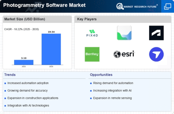
The market for photogrammetry software has seen notable changes recently, which is indicative of the expanding need for sophisticated mapping and imaging solutions across a range of sectors. The method of obtaining geometric information from two-dimensional photos called photogrammetry has become indispensable in fields like mapping, 3D modeling, and surveying. Technological developments, growing recognition of photogrammetry's advantages, and an increasing need for precise geographical data all influence the market dynamics. The quick development of imaging and data processing technologies is one of the main factors influencing market dynamics.
Software suppliers for photogrammetry are always trying to improve their offerings by adding new algorithms and machine learning strategies. This enhances the precision and efficacy of photogrammetric procedures while permitting the retrieval of intricate details from intricate pictures. The upshot is that photogrammetry software is being used more and more by a variety of businesses to simplify their operations, from agriculture and construction to urban planning and archeology. The way in which organizations and professionals are becoming more aware of the benefits of photogrammetry also has an impact on market dynamics. High-resolution aerial photography and accurate 3D models may be produced, which is a useful tool for project planning, risk assessment, and decision-making. With more companies realizing how photogrammetry may improve their processes, there is an increasing need for sophisticated software solutions.
A positive feedback loop is being created by this greater awareness, which is encouraging more invention and improvement in the photogrammetry software. Furthermore, photogrammetry is being more widely used in fields like environmental monitoring and natural resource management as a result of the increased emphasis on sustainable development and effective resource management on a worldwide scale. Making educated judgments about land use, conservation initiatives, and infrastructure development is made easier with the use of photogrammetry, which provides precise and current spatial information. Because governments and organizations are looking for cutting-edge instruments to assure responsible development practices and solve ecological concerns, this environmental focus has grown to be a key influence in driving market dynamics.
The growing need for real-time and on-demand mapping solutions further affects the market dynamics of photogrammetry software. For efficient decision-making, sectors like emergency response, disaster management, and infrastructure maintenance need instant access to precise geographical data. Photogrammetry software that offers real-time processing capabilities and cloud-based solutions is gaining traction, enabling users to obtain up-to-the-minute information for timely responses and interventions.


Leave a Comment