Regulatory Support and Frameworks
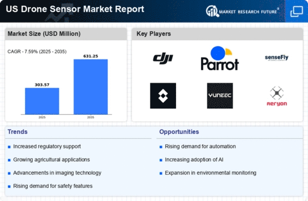
The regulatory landscape plays a crucial role in shaping the drone sensor market. In the US, the Federal Aviation Administration (FAA) has established guidelines that facilitate the safe integration of drones into national airspace. These regulations not only promote the use of drones for commercial purposes but also encourage the development of advanced sensor technologies. The FAA's initiatives, such as the Remote Identification rule, are expected to enhance safety and accountability, thereby fostering market growth. As of 2025, the drone sensor market is anticipated to benefit from these regulatory frameworks, which may lead to increased investments and innovations in sensor technologies. The supportive regulatory environment is likely to attract new entrants and stimulate competition, further driving advancements in the drone sensor market.
Expansion of Delivery and Logistics Services
The market is poised for growth due to the expansion of delivery and logistics services. Companies are increasingly exploring the use of drones for last-mile delivery, which necessitates the integration of sophisticated sensors for navigation and obstacle detection. The market for drone sensors in logistics is expected to witness a substantial increase, with estimates suggesting a growth rate of around 20% annually. This trend is driven by the need for efficient and cost-effective delivery solutions, particularly in urban areas. As e-commerce continues to flourish, the demand for reliable drone delivery systems will likely rise, necessitating advancements in sensor technologies. The market is thus expected to play a pivotal role in the evolution of logistics and delivery services.
Increased Investment in Research and Development
Investment in research and development (R&D) is a key driver of innovation within the drone sensor market. Companies are allocating substantial resources to develop cutting-edge sensor technologies that enhance drone capabilities. This focus on R&D is likely to yield advancements in sensor accuracy, range, and functionality, which are essential for various applications, including agriculture, environmental monitoring, and infrastructure inspection. As of 2025, it is estimated that R&D expenditures in the drone sensor market could exceed $1 billion, reflecting a growing commitment to innovation. This influx of investment is expected to foster collaboration between industry players and research institutions, leading to the development of next-generation sensors that could redefine the capabilities of drones in multiple sectors.
Technological Advancements in Sensor Capabilities
The drone sensor market is experiencing rapid growth due to continuous technological advancements in sensor capabilities. Innovations in miniaturization and integration of advanced sensors, such as LiDAR and multispectral imaging, enhance the functionality of drones across various applications. For instance, the incorporation of high-resolution cameras and thermal sensors allows for improved data collection in sectors like agriculture and infrastructure inspection. The market is projected to reach approximately $5 billion by 2026, indicating a compound annual growth rate (CAGR) of around 15%. This growth is driven by the increasing demand for precise data and real-time analytics, which are essential for decision-making processes in various industries. As these technologies evolve, they are likely to further propel the drone sensor market, making it a pivotal component in the broader drone ecosystem.
Growing Demand for Surveillance and Security Applications
The increasing need for surveillance and security solutions is significantly impacting the drone sensor market. Drones equipped with advanced sensors are being deployed for various security applications, including border patrol, disaster management, and urban surveillance. The market for drone sensors in security applications is projected to grow at a CAGR of approximately 18% over the next few years. This surge is attributed to the rising concerns over public safety and the need for efficient monitoring systems. Law enforcement agencies and private security firms are increasingly adopting drone technology to enhance their operational capabilities. Consequently, the demand for high-performance sensors, such as thermal imaging and motion detection systems, is likely to escalate, further propelling the growth of the drone sensor market.


