US Airborne Lidar Market
US Airborne Lidar Market Research Report: By Application (Mapping, Forest Management, Archaeology, Urban Planning, Coastal Studies), By Technology (Laser Scanning, Photographic LiDAR, Bathymetric LiDAR, Multispectral LiDAR), By End Use (Government Agencies, Construction Development, Environmental Monitoring, Transportation) and By Platform (Fixed-Wing Aircraft, Helicopters, Drones, Satellite) - Forecast to 2035.
US Airborne Lidar Market Overview:
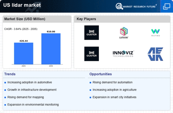
As per MRFR analysis, the US Airborne Lidar Market Size was estimated at 638.4 (USD Million) in 2023. The US Airborne Lidar Market Industry is expected to grow from 750(USD Million) in 2024 to 2,300 (USD Million) by 2035. The US Airborne Lidar Market CAGR (growth rate) is expected to be around 10.724% during the forecast period (2025 - 2035).
Key US Airborne Lidar Market Trends Highlighted
The US Airborne Lidar Market is experiencing significant growth driven by advancements in technology and increasing demand for high-resolution mapping. Key market drivers include the rising need for precise topographical data in urban planning, environmental monitoring, and disaster management. Government initiatives in the US, such as the Geospatial Data Act, reflect a greater emphasis on utilizing remote sensing technologies, including Lidar, for better resource management and infrastructure development. This move encourages both public and private sectors to adopt airborne Lidar systems for enhanced decision-making processes. Opportunities are emerging in various sectors, particularly in forestry management, where Lidar's ability to provide detailed vegetation analysis can aid in sustainable practices.The US continues to invest in infrastructure projects, creating a demand for accurate land surveys and assessments, further propelling the adoption of aerial Lidar systems. Recent trends indicate a growing collaboration between technology companies and government agencies, aiming to develop more sophisticated and user-friendly Lidar solutions. Additionally, the integration of Artificial Intelligence with airborne Lidar data is on the rise, enabling more efficient data analysis and interpretation. In recent times, there has also been a shift towards the utilization of small Unmanned Aerial Vehicles (UAVs) equipped with Lidar, offering flexibility in data collection and reducing operational costs.This trend is particularly relevant in the US, where regulations have adapted to facilitate drone use in mapping services. Overall, the US Airborne Lidar Market reflects a dynamic landscape, combining innovation with a clear focus on sustainable development and efficient resource management.
Source: Primary Research, Secondary Research, MRFR Database and Analyst Review
US Airborne Lidar Market Drivers
Increasing Demand for Geographic Information Systems in Infrastructure Development
The US Airborne Lidar Market Industry is significantly driven by the surging demand for Geographic Information Systems (GIS) in infrastructure development projects across the United States. As the country focuses on enhancing its infrastructure, the necessary and precise topographical data provided by Airborne Lidar systems becomes crucial. According to the US Department of Transportation, federal investments in transportation infrastructure are projected to grow by over $500 billion in the coming years, underscoring the urgency for accurate spatial data.This increasing funding enables state and local agencies to utilize Airborne Lidar data for planning, design, and maintenance of public works projects. Leading organizations like the American Society of Civil Engineers emphasize that incorporating Lidar data can increase project efficiency by up to 30%, illustrating its vital role in modernizing infrastructure in the US. Consequently, the need for advanced imagery and mapping solutions is expected to fuel the growth of the US Airborne Lidar Market.
Advancements in Airborne Lidar Technology
Continuous advancements in Airborne Lidar technology are a major driver for the US Airborne Lidar Market Industry. Innovations, such as higher resolution sensors and real-time data processing capabilities, are enhancing the appeal of Lidar solutions in various sectors, including forestry management, urban planning, and environmental monitoring. According to the US Geological Survey, the introduction of new Lidar sensors has increased image resolution by 50%, enabling far more detailed and accurate mapping.Major technology companies are investing in Research and Development to improve Lidar capabilities, which not only enhance data accuracy but also expand applications into new industries. For instance, companies like Leica Geosystems are continually pushing technological boundaries, thereby contributing to the exponential growth of this market segment.
Government Initiatives and Funding for Environmental Programs
The US governmentโs increasing investment in environmental initiatives is significantly contributing to the expansion of the US Airborne Lidar Market Industry. These initiatives often require high-precision mapping to monitor changes in ecosystems, urban sprawl, and flood risks. The Federal Geographic Data Committee has set a goal of improving the availability of high-quality geographic data across the United States, allocating substantial resources for Lidar mapping of forest cover and topographical changes.Recent studies indicate that high-resolution Lidar data can improve flood risk assessments by up to 40%, fostering better preparedness for natural disasters. Organizations such as the National Oceanic and Atmospheric Administration emphasize the importance of Lidar in climate change studies, further heightening the market demand for such technology.
US Airborne Lidar Market Segment Insights:
Airborne Lidar Market Application Insights
The US Airborne Lidar Market is witnessing robust growth, driven primarily by its diverse applications across various sectors. This technology plays a crucial role in Mapping, allowing for enhanced accuracy and detail in geographical data collection, which is vital for infrastructure development and environmental assessment. Forest Management benefits significantly from airborne lidar as it facilitates accurate tree height measurements and biomass estimates, aiding in sustainable resource management practices. In the realm of Archaeology, lidar has emerged as a transformative tool, enabling researchers to uncover ancient structures and landscapes obscured by dense vegetation, thereby enriching historical studies.Urban Planning is increasingly utilizing airborne lidar for 3D modeling of urban landscapes, which supports efficient city planning and development initiatives. Coastal Studies rely on this technology to monitor shoreline changes and assess the impact of natural disasters, ensuring better preparedness and response strategies. Collectively, these applications underline the growing significance of the US Airborne Lidar Market, as they combine technological advancements with practical solutions to address contemporary challenges across multiple industries.The ongoing innovations and expanding use cases position the market favorably for future growth, highlighting opportunities for further development and investment. As environmental concerns rise, the capability of airborne lidar to provide precise, comprehensive data becomes critical in shaping policies and decision-making processes across both governmental and private sectors in the US. This sophisticated technology has become an indispensable asset in facilitating informed strategic planning and fostering sustainable practices that align with the nation's broader economic and ecological goals.
Source: Primary Research, Secondary Research, MRFR Database and Analyst Review
Airborne Lidar Market Technology Insights
The Technology segment of the US Airborne Lidar Market encompasses various advanced methods, each playing a crucial role in the overall functionality and application of LiDAR systems. Laser Scanning, a prominent technology, is widely used for its high-resolution data capture capabilities, making it vital for applications like topographical mapping and urban planning. Photographic LiDAR enhances traditional imaging by integrating visual information with 3D data, which is significant in heritage preservation and environmental monitoring. Bathymetric LiDAR, on the other hand, specializes in underwater depth measurements, essential for coastal management and marine studies.Multispectral LiDAR provides a deeper insight into land cover and vegetation health, facilitating agricultural applications and forest management, thus supporting sustainable practices. The diverse range of technologies within the US Airborne Lidar Market contributes significantly to its growth, driven by increasing demand for precise mapping and modeling across various sectors. As the industry evolves, these technologies continually adapt, opening new avenues for research and application, thereby ensuring their dominance in market trends and opportunities.
Airborne Lidar Market End Use Insights
The US Airborne Lidar Market reveals significant insights across its End Use segment, showcasing its diverse applications. Government agencies utilize airborne Lidar for a wide range of purposes, including land surveying, urban planning, and environmental assessments, contributing to effective governance and resource management. In the realm of construction development, the technology enhances site analysis and project management, enabling accurate mapping and reducing construction risks. Environmental monitoring benefits greatly from airborne Lidar's ability to assess vegetation health, monitor deforestation, and evaluate natural disasters, making it a vital tool for sustainability efforts.The transportation sector also leverages this technology for infrastructure planning and maintenance, ensuring safety and efficiency in transport networks. Collectively, these segments drive innovation and growth within the US Airborne Lidar Market, addressing critical challenges while capitalizing on emerging opportunities. The demand for precise data and analytics across these applications is likely to foster advancements in Lidar technology, further solidifying its importance in various industries.
Airborne Lidar Market Platform Insights
The US Airborne Lidar Market is showing remarkable growth, particularly in the Platform segment, which includes Fixed-Wing Aircraft, Helicopters, Drones, and Satellites. Fixed-Wing Aircraft are known for their ability to cover large areas quickly, making them ideal for extensive mapping and surveying tasks. Conversely, Helicopters offer greater maneuverability and are well-suited for urban environments and complex topographies, enabling detailed data collection in challenging conditions. Drones are increasingly popular due to their cost-effectiveness and versatility, especially in smaller-scale projects, agriculture, and environmental monitoring.Satellites provide a broader overview of land use and climate patterns, yielding critical data for long-term planning and research. The integration of these platforms in the US Airborne Lidar Market significantly enhances operational efficiency and accuracy. The market is driven by technological advancements and increasing demand in sectors like construction, forestry, and disaster management, where precise data is invaluable for decision-making. However, challenges such as regulatory hurdles and data privacy concerns must be addressed to facilitate continued growth and adoption across these platforms.Each platform plays a crucial role in meeting the diverse needs of the market, ensuring comprehensive application across various industries.
US Airborne Lidar Market Key Players and Competitive Insights:
The US Airborne Lidar Market has experienced substantial growth and transformation as advancements in technology and increasing applications across various sectors, such as defense, agriculture, and environmental monitoring, have emerged. The competition within this market is driven by the need for precision, efficiency, and high-resolution mapping capabilities. Key players are continually innovating to provide state-of-the-art airborne Lidar systems that cater to diverse needs while ensuring adaptability and scalability. Factors such as regulatory requirements, integration with other technologies, and advancements in data processing capabilities play a significant role in shaping competitive dynamics. A thorough understanding of the competitive landscape requires analyzing company strategies, market positioning, product offerings, and customer engagement, all of which contribute to establishing a foothold in the lucrative airborne Lidar domain.Raytheon Technologies stands as a formidable competitor in the US Airborne Lidar Market, leveraging its vast experience in aerospace and defense. The company has made significant strides in integrating Lidar technology into its existing product lines, which enhances reconnaissance and surveillance capabilities for military applications. Furthermore, Raytheon Technologies benefits from strong relationships with key government programs and agencies, which positions it favorably for new contract opportunities. The companyโs emphasis on innovation has resulted in the development of customized solutions designed to meet specific needs in various sectors, thereby solidifying its presence in the market. The breadth of Raytheon Technologies' expertise also empowers it to provide comprehensive support and after-sales service, enhancing customer satisfaction and loyalty throughout the lifecycle of its products.Airbus has also established a palpable presence in the US Airborne Lidar Market with its commitment to innovation and high-quality engineering. The company offers state-of-the-art airborne sensors and data processing software that contribute to effective mapping and monitoring solutions. Airbus specializes in providing integrated solutions tailored to the needs of government, commercial, and scientific sectors, showcasing its versatility and adaptability in addressing varying market demands. The company has strategically pursued partnerships and collaborations to expand its technological footprint, enhancing its capabilities in the airborne imaging sector. Furthermore, Airbus has engaged in mergers and acquisitions to consolidate its market position and diversify its portfolio, thus ensuring its competitive advantage remains robust. Overall, Airbus continues to innovate and evolve within the US airborne Lidar landscape, reinforcing its status as a trusted leader in providing advanced technological solutions.
Key Companies in the US Airborne Lidar Market Include:
Raytheon Technologies
Airbus
Fugro
Leica Geosystems
GeoDigital
Aerial Surveying Solutions
L3Harris Technologies
Woolpert
Hexagon AB
Riegl USA
MDA
Teledyne Technologies
Northrop Grumman
Quantum Spatial
US Airborne Lidar Market Industry Developments
Recent developments in the US Airborne Lidar Market have seen significant advancements and collaborations among key players such as Raytheon Technologies, Airbus, and L3Harris Technologies. In October 2023, Raytheon Technologies announced an expansion of its Lidar capabilities through a partnership with Fugro, aiming to enhance data collection for environmental monitoring. Meanwhile, Leica Geosystems has integrated new Lidar technology into its existing solutions to improve mapping accuracy. Current affairs include increased government spending in infrastructure, leading to a higher demand for Lidar services to support urban planning and environmental assessments. Companies like Woolpert and Hexagon AB are particularly benefiting from this trend as they provide comprehensive surveying solutions.In September 2023, MDA acquired Teledyne Technologies' remote sensing division, enhancing its position in the market by expanding its service offerings in lidar data processing. The market value for US Airborne Lidar services has seen a robust growth rate, expected to reach an estimated $1.5 billion by 2024, driven by the increasing adoption of Lidar technology in various sectors, including agriculture, forestry, and construction. Notable advancements over the past couple of years also include the 2022 rollout of enhanced unmanned aerial vehicle (UAV) Lidar systems by Northrop Grumman to support defense operations.
US Airborne Lidar Market Segmentation Insights
Airborne Lidar Market Application Outlook
Mapping
Forest Management
Archaeology
Urban Planning
Coastal Studies
Airborne Lidar Market Technology Outlook
Laser Scanning
Photographic LiDAR
Bathymetric LiDAR
Multispectral LiDAR
Airborne Lidar Market End Use Outlook
Government Agencies
Construction Development
Environmental Monitoring
Transportation
Airborne Lidar Market Platform Outlook
Fixed-Wing Aircraft
Helicopters
Drones
Satellite
Report Scope:
Report Attribute/Metric Source: |
Details |
MARKET SIZE 2018 |
638.4(USD Million) |
,
MARKET SIZE 2024 |
750.0(USD Million) |
,
MARKET SIZE 2035 |
2300.0(USD Million) |
,
COMPOUND ANNUAL GROWTH RATE (CAGR) |
10.724% (2025 - 2035) |
,
REPORT COVERAGE |
Revenue Forecast, Competitive Landscape, Growth Factors, and Trends |
,
BASE YEAR |
2024 |
,
MARKET FORECAST PERIOD |
2025 - 2035 |
,
HISTORICAL DATA |
2019 - 2024 |
,
MARKET FORECAST UNITS |
USD Million |
,
KEY COMPANIES PROFILED |
Raytheon Technologies, Airbus, Fugro, Leica Geosystems, GeoDigital, Aerial Surveying Solutions, L3Harris Technologies, Woolpert, Hexagon AB, Riegl USA, MDA, Teledyne Technologies, Northrop Grumman, Quantum Spatial |
,
SEGMENTS COVERED |
Application, Technology, End Use, Platform |
,
KEY MARKET OPPORTUNITIES |
Increased demand in forestry management, Urban planning and infrastructure development, Emerging applications in agriculture, Advancements in drone technology, Growing environmental monitoring needs |
,
KEY MARKET DYNAMICS |
Technological advancements in LiDAR, Increasing demand for geospatial data, Government investments in infrastructure, Growing environmental monitoring needs, Rising applications in agriculture |
,
COUNTRIES COVERED |
US |
Frequently Asked Questions (FAQ) :
The US Airborne Lidar Market is expected to be valued at 750.0 USD Million in 2024.
By 2035, the US Airborne Lidar Market is anticipated to reach a valuation of 2300.0 USD Million.
The expected CAGR for the US Airborne Lidar Market between 2025 and 2035 is 10.724%.
The Mapping application is projected to generate 800.0 USD Million in the US Airborne Lidar Market by 2035.
In 2035, the market size for Forest Management within the US Airborne Lidar Market is expected to reach 450.0 USD Million.
Major players in the US Airborne Lidar Market include Raytheon Technologies, Airbus, Fugro, and Leica Geosystems.
The Urban Planning segment of the US Airborne Lidar Market is expected to grow to 600.0 USD Million by 2035.
The Archaeology application is expected to be valued at 100.0 USD Million in 2024.
By 2035, the Coastal Studies segment is expected to generate 150.0 USD Million.
Challenges in the US Airborne Lidar Market may include technological advancements and regulatory hurdles affecting market growth.